Layers Reference
Flash flood forecast summary (0-120h)
Official Warnings
Definition
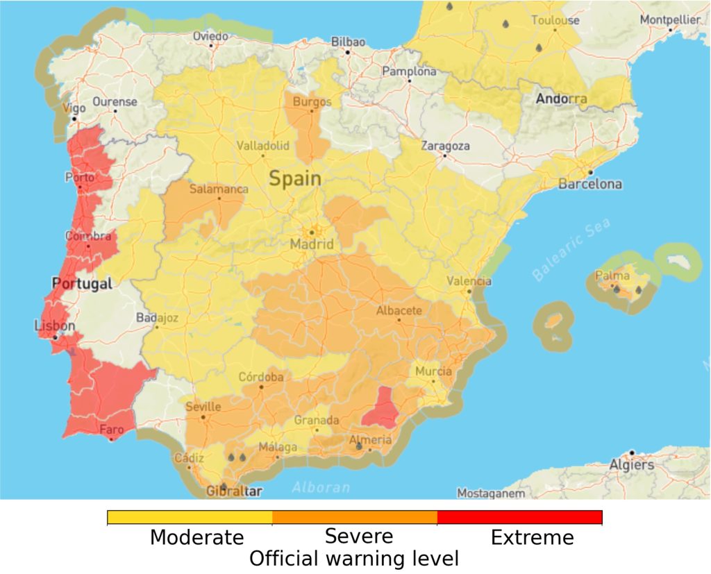
Summarises the warnings generated by the National Meteorological and Hydrological Services (NMHSs) across 37 European countries. Covering 12 types of hazards, these warnings are sourced from MeteoAlarm, developed by EUMETNET. The warnings are categorised as follows:
- Moderate (Yellow)
- Severe (Orange)
- Extreme (Red)
| Spatial coverage | Europe – only countries who are part of EUMETNET MeteoAlarm initiative |
| Spatial resolution | Administrative regions |
| Temporal resolution | 1-hour |
| Maximum lead time | 120-hours (5-days) |
| Update frequency | Hourly |
| Units | Official warning level (Moderate, Severe, Extreme) |
Inputs
- EUMETNET MeteoAlarm warnings
Seamless precipitation accumulation
Definition
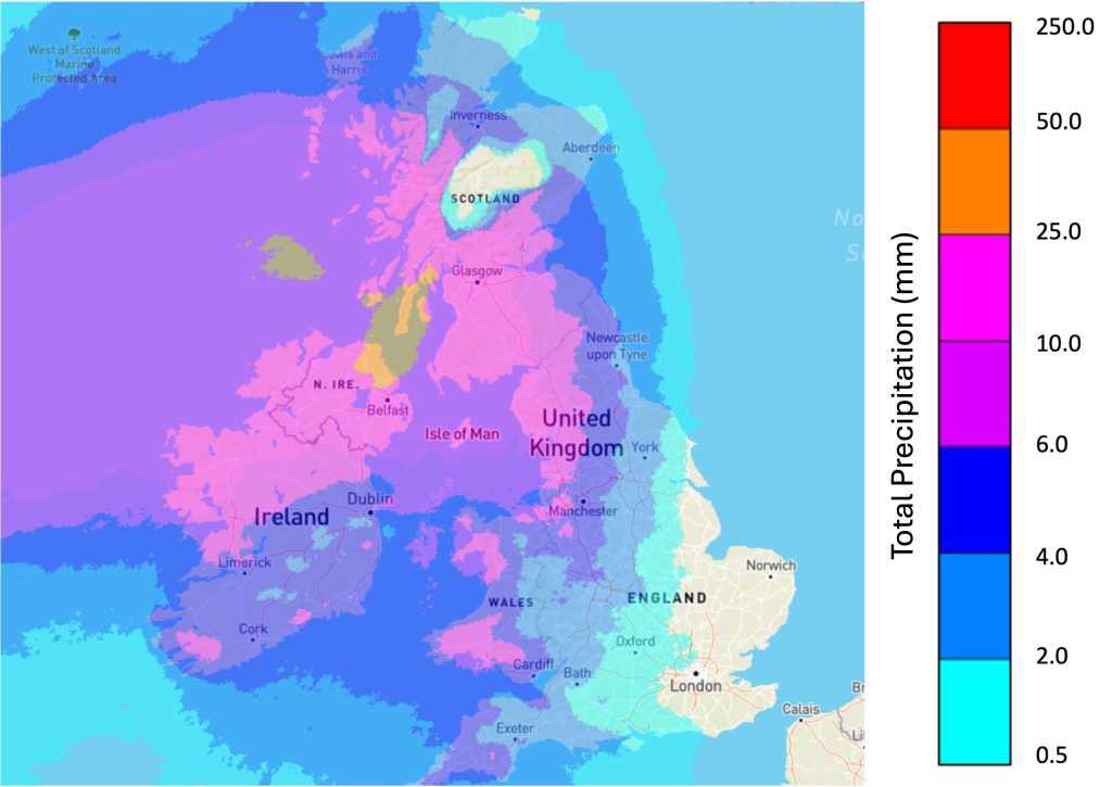
Precipitation accumulations are forecasted over the next 5 days and displayed as summaries for four lead-time windows: 0-6h, 6-24h, 24-48h, and 48-120h. These accumulations are derived from a blend of radar observations and Numerical Weather Prediction (NWP) data. The total accumulated precipitation in each lead time window is computed from the 80th percentile of the blended forecast ensemble.
| Spatial coverage | Europe – EFAS domain |
| Spatial resolution | 2-km |
| Temporal resolution | Lead time windows: 0-6h, 6-24h, 24-48h, 48-120h |
| Maximum lead time | 120-hours (5-days) |
| Update frequency | Hourly |
| Units | Total precipitation (mm) per accumulation period |
Inputs
- Radar based 20-member ensemble nowcasts
- ECMWF 51-member ensemble forecasts from the Integrated Forecasting System (IFS)
Methods
Flash flood impact over sub-catchment
Definition
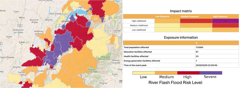
River sub-catchments shaded according to their maximum forecasted river flash flood impact level over lead times of 0-6h, 6-24h, 24-48h and 48-120h. When a sub-catchment is clicked, a pop-out window appears displaying more information about the forecast.
| Spatial coverage | Europe – EFAS domain |
| Spatial resolution | River sub-catchments |
| Temporal resolution | Lead time windows: 0-6h, 6-24h, 24-48h, 48-120h |
| Maximum lead time | 120-hours (5-days) |
| Update frequency | Hourly |
| Units | Impact level (Low, Medium, High, Severe) |
Inputs
- Radar based 20-member ensemble nowcasts
- ECMWF 51-member ensemble forecasts from the Integrated Forecasting System (IFS)
- Exposure – based on combination of population and critical infrastructure
Methods
Storm risk
Definition
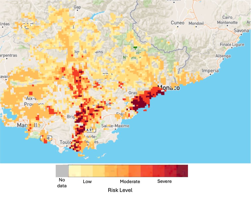
Maximum storm risk level over the next 3-hours due to the maximum of the risk from lightning, wind and precipitation.
| Spatial coverage | Europe – only areas covered by OPERA composite |
| Spatial resolution | 2-km |
| Temporal resolution | Lead time window: 0-3h |
| Maximum lead time | 3-hours |
| Update frequency | 15-minutes |
| Units | Storm risk level (Low, Moderate, Severe) |
Inputs
- Radar rainfall nowcast from the SimVP neural network model
- NWP forecasts of, Convective Available Potential Energy (CAPE), u- and v- wind components from the ECMWF IFS
Methods
Storm Impact
The layers in this block are recommended to inform about the potential risk of flash flooding in urban areas. They highlight areas, including urban areas, where heavy rainfall is predicted, and also highlight the risks associated with lightning and wind hazards. The maximum lead time of these products is between 3-4 hours.
Radar reflectivity OPERA
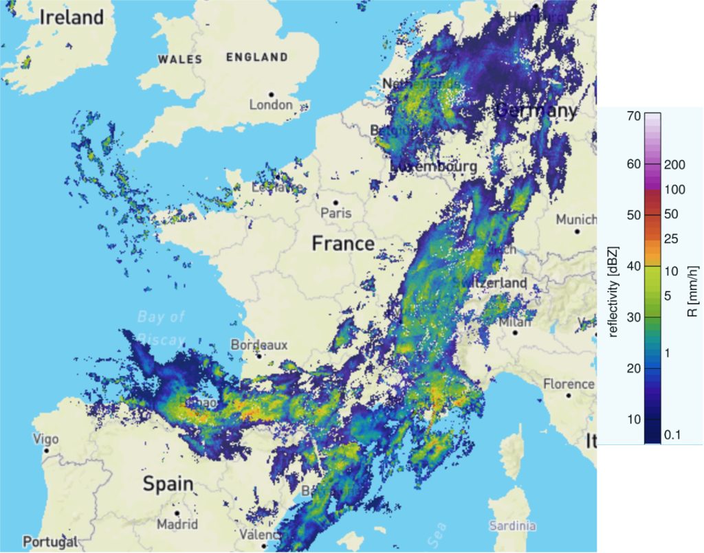
Definition
Reflectivity values observed by the EUMETNET OPERA radar composite at the selected time and extrapolated up to 3-hours ahead using SBMCast.
| Spatial coverage | Europe – only areas covered by OPERA composite |
| Spatial resolution | 2-km |
| Temporal resolution | 15-minutes |
| Maximum lead time | 3-hours |
| Update frequency | 15-minutes |
| Units | Reflectivity (dBZ – decibels (dB) relative to reflectivity (Z)) |
Inputs
- EUMETNET OPERA radar composite
Methods
- SBMCast for extrapolation (Berenguer et al., 2011), see Radar Rainfall Nowcasting
SimVP OPERA
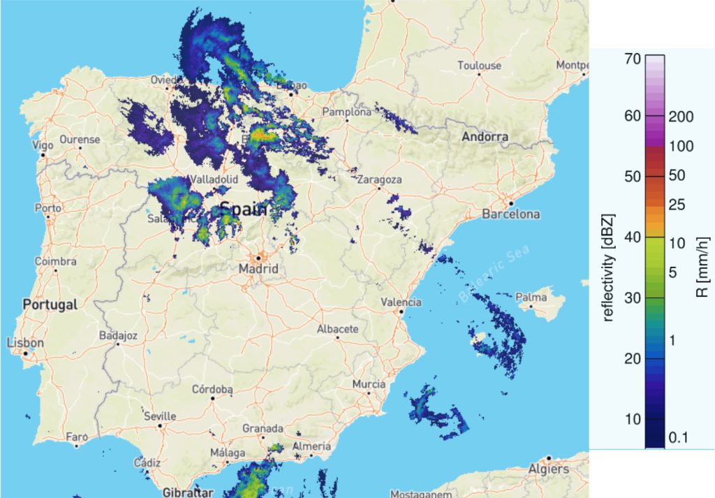
Definition
Reflectivity values observed by the EUMETNET OPERA radar composite at the selected time and extrapolated up to 3-hours ahead using SimVP (an artificial intelligence method which is based on a convolutional neural network).
| Spatial coverage | Europe – only areas covered by OPERA composite |
| Spatial resolution | 2-km |
| Temporal resolution | 15-minutes |
| Maximum lead time | 3-hours |
| Update frequency | 15-minutes |
| Units | Reflectivity (dBZ – decibels (dB) relative to reflectivity (Z)) |
Inputs
- EUMETNET OPERA radar composite
Methods
- SimVP (simpler yet better Video Prediction – Tan et al., 2025) for extrapolation, see Precipitation hazard and risk
Hourly precipitation - radar nowcasting
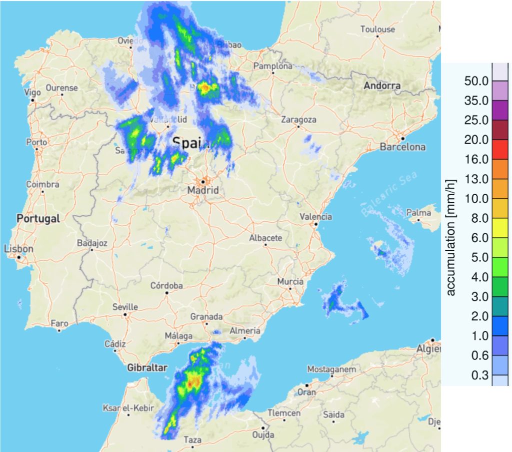
Definition
Hourly rainfall accumulations estimated from the observed and extrapolated radar reflectivity values created from the EUMETNET OPERA radar composite, which were extrapolated using SBMCast.
| Spatial coverage | Europe – only areas covered by OPERA composite |
| Spatial resolution | 2-km |
| Temporal resolution | 15-minutes |
| Maximum lead time | 3-hours |
| Update frequency | 15-minutes |
| Units | mm/h (millimetres per hour) |
Inputs
- EUMETNET OPERA radar composite
Methods
- SBMCast for extrapolation (Berenguer et al., 2011), see Radar Rainfall Nowcasting
Lightning Hazard
Definition
Areas at risk of lightning hazards (classified as one of three hazard levels) during the next 3-hours in the Scandinavian region, including Estonia and Latvia.
| Spatial coverage | Scandinavia (Sweden, Norway, Finland, Denmark), Estonia, Latvia |
| Spatial resolution | 2-km |
| Temporal resolution | 15-minutes |
| Maximum lead time | 3-hours |
| Update frequency | 15-minutes |
| Units | Hazard level (Low, Moderate, Severe) |
Inputs
- NORDLIS flash observations (Mäkelä et al., 2014)
Methods
- PySTEPS (Pulkkinen et al., 2019) for extrapolation of gridded flash densities
- See Lightning hazard and risk
Wind Hazard
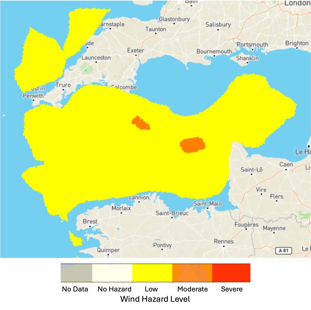
Definition
Wind hazard forecasted across Europe over the next 3-hours classified into one of three hazard levels.
| Spatial coverage | Europe – only areas covered by OPERA composite |
| Spatial resolution | 2-km |
| Temporal resolution | 15-minutes |
| Maximum lead time | 3-hours |
| Update frequency | 15-minutes |
| Units | Hazard level (Low, Moderate, Severe) |
Inputs
- u- and v- wind components forecasted from the control member of the ECMWF IFS
Methods
- Original 3-hour, ~9-km resolution forecasts, interpolated to 2-km OPERA resolution with 15-minute timesteps
- See Wind hazard and risk
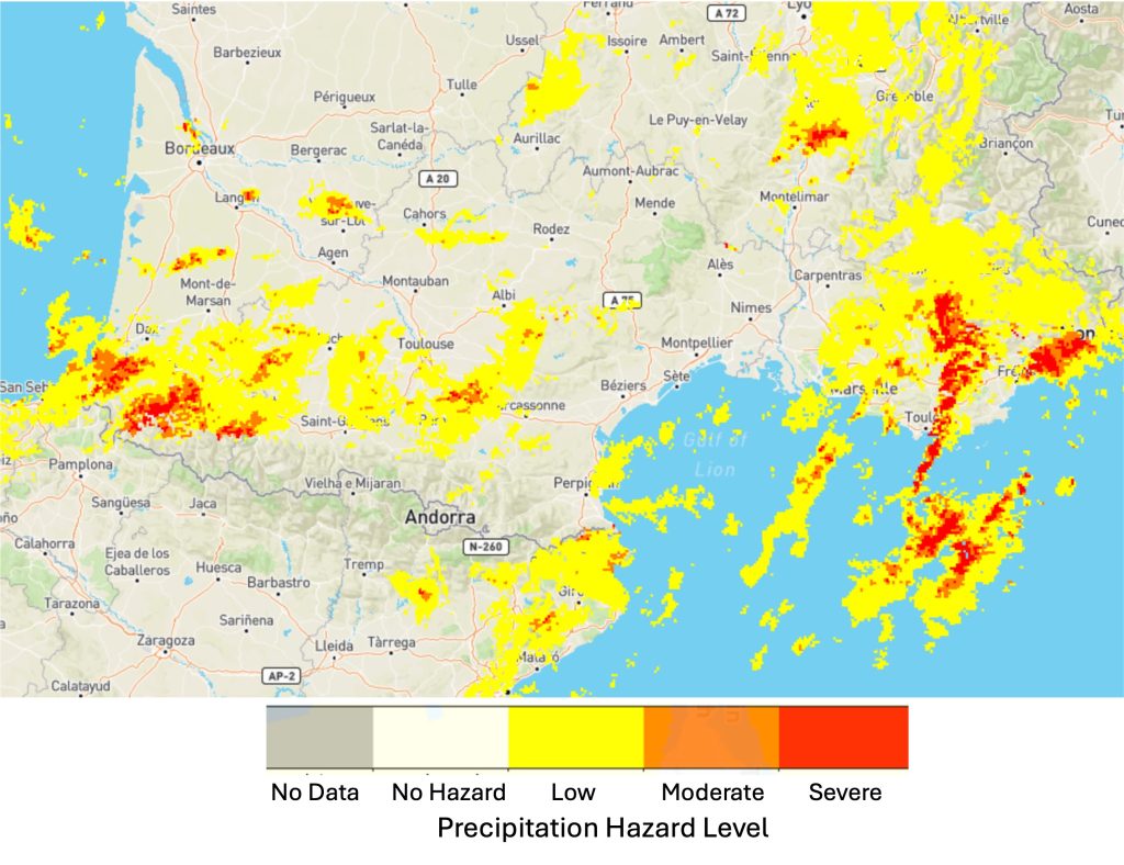
Precipitation Hazard
Definition
Precipitation hazard level over the next 3-hours across Europe, calculated from extrapolated radar reflectivity observations from the EUMETNET OPERA radar composite.
| Spatial coverage | Europe – only areas covered by OPERA composite |
| Spatial resolution | 2-km |
| Temporal resolution | 15-minutes |
| Maximum lead time | 3-hours |
| Update frequency | 15-minutes |
| Units | Hazard level (Low, Moderate, Severe) |
Inputs
- EUMETNET OPERA radar composite
Methods
- SimVP (simpler yet better Video Prediction – Tan et al., 2025) for extrapolation
- See Precipitation hazard and risk
Lightning Risk
Definition
Risk level associated with the forecast lightning hazard over the next 3-hours in the Scandinavian region, including Estonia and Latvia.
| Spatial coverage | Scandinavia (Sweden, Norway, Finland, Denmark), Estonia, Latvia |
| Spatial resolution | 2-km |
| Temporal resolution | 15-minutes |
| Maximum lead time | 3-hours |
| Update frequency | 15-minutes |
| Units | Risk level (Low, Moderate, Severe) |
Inputs
- Lightning hazard forecast
- Population and critical infrastructure exposure (see static layers)
Methods
- Risk level = lightning hazard * exposure
- See Lightning hazard and risk
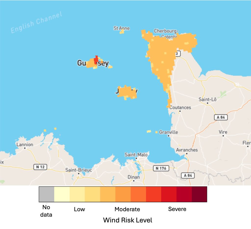
Wind Risk
Definition
Risk level associated with the forecast wind hazard over the next 3-hours across Europe.
| Spatial coverage | Europe – only areas covered by OPERA composite |
| Spatial resolution | 2-km |
| Temporal resolution | 15-minutes |
| Maximum lead time | 3-hours |
| Update frequency | 15-minutes |
| Units | Risk level (Low, Moderate, Severe) |
Inputs
- Wind hazard forecast
- Population and critical infrastructure exposure (see static layers)
Methods
- Risk level = wind hazard * exposure
- See Wind hazard and risk
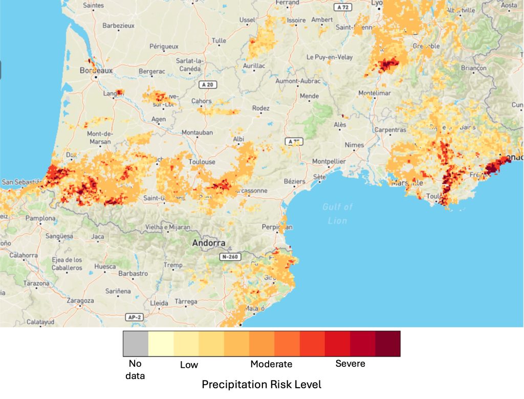
Precipitation Risk
Definition
Risk level associated with the forecast precipitation hazard over the next 3-hours across Europe.
| Spatial coverage | Europe – only areas covered by OPERA composite |
| Spatial resolution | 2-km |
| Temporal resolution | 15-minutes |
| Maximum lead time | 3-hours |
| Update frequency | 15-minutes |
| Units | Risk level (Low, Moderate, Severe) |
Inputs
- Precipitation hazard forecast
- Population and critical infrastructure exposure (see static layers)
Methods
- Precipitation level = precipitation hazard * exposure
- See Precipitation hazard and risk
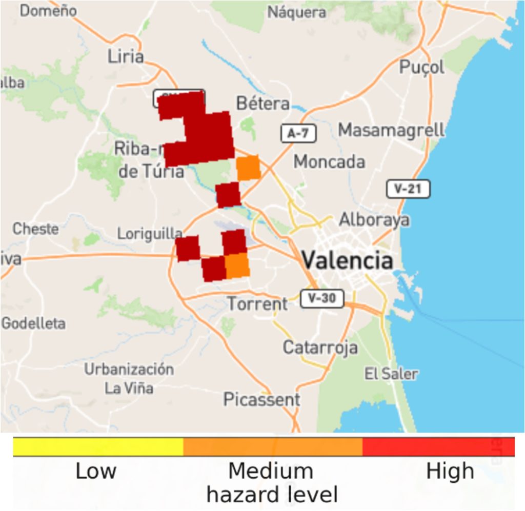
Pluvial flood hazard in urban areas
Definition
Pluvial flood hazard level in urban areas over the next 4-hours where heavy rain is forecasted.
| Spatial coverage | Europe – only areas covered by OPERA composite |
| Spatial resolution | 1-km |
| Temporal resolution | 15-minutes |
| Maximum lead time | 4-hours |
| Update frequency | 15-minutes |
| Units | Hazard level (Low, Medium, High) |
Inputs
- Hourly precipitation – radar nowcasting layer
- CORINE land cover dataset to define urban areas
Methods
Animated Flash Flood Nowcasting
Official Warnings
Definition
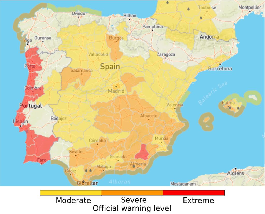
Summarises the warnings for each hour over the next 6-hours generated by the National Meteorological and Hydrological Services (NMHSs) across 37 European countries. Covering 12 types of hazards, these warnings are sourced from MeteoAlarm, developed by EUMETNET. The warnings are categorised as follows:
- Moderate (Yellow)
- Severe (Orange)
- Extreme (Red)
| Spatial coverage | Europe – only countries who are part of EUMETNET MeteoAlarm initiative |
| Spatial resolution | Administrative regions |
| Temporal resolution | 1-hour |
| Maximum lead time | 6-hours |
| Update frequency | Hourly |
| Units | Official warning level (Moderate, Severe, Extreme) |
Inputs
- EUMETNET MeteoAlarm warnings
Hourly precipitation 80th percentile
Definition
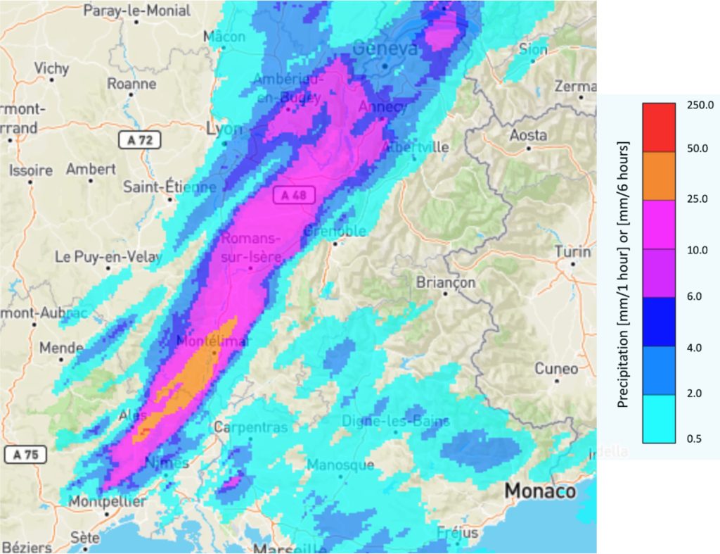
Hourly rainfall accumulations up to 6-hours ahead from the 80th percentile of the 51-member ensemble forecast created from a blending of a radar nowcast and the ECMWF IFS.
| Spatial coverage | Europe – EFAS domain |
| Spatial resolution | 2-km |
| Temporal resolution | 1-hour |
| Maximum lead time | 6-hours |
| Update frequency | Hourly |
| Units | mm/hour (millimetres per hour) |
Inputs
- 20-member ensemble radar nowcast derived from EUMETNET OPERA radar composite
- 51-member ensemble NWP of total precipitation from the ECMWF IFS
Methods
Hourly precipitation - radar nowcasting
Definition
Hourly rainfall accumulations estimated from the observed and extrapolated radar reflectivity values created from the EUMETNET OPERA radar composite, which were extrapolated using SBMCast.
| Spatial coverage | Europe – only areas covered by OPERA composite |
| Spatial resolution | 2-km |
| Temporal resolution | 1-hour |
| Maximum lead time | 4-hours |
| Update frequency | 1-hour |
| Units | mm/hour (millimetres per hour) |
Inputs
- EUMETNET OPERA radar composite
Methods
- SBMCast for extrapolation (Berenguer et al., 2011), see Radar rainfall nowcasting
Flash flood impact over the river network
Definition
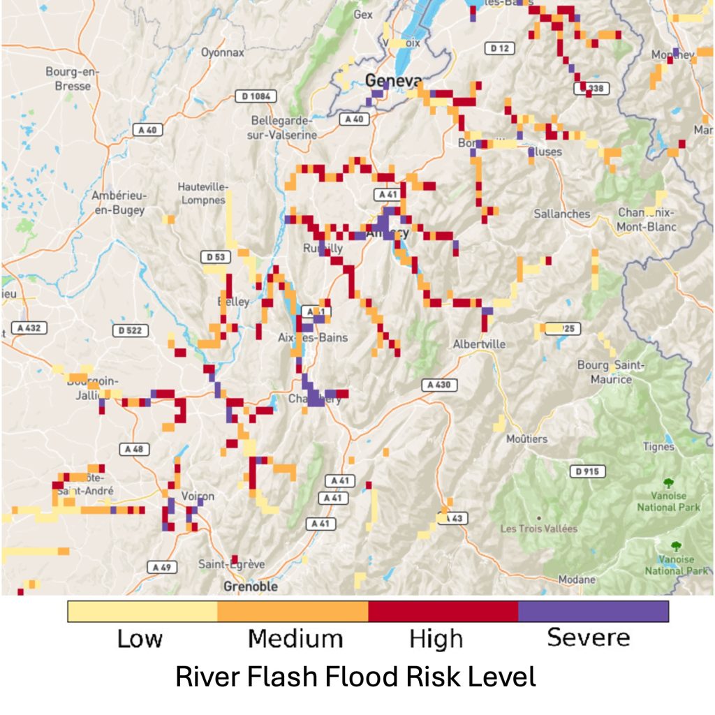
Hourly forecasts of flash flood risk level (pertaining to potential impacts) over the river network over the next 6 hours.
| Spatial coverage | Europe – EFAS domain |
| Spatial resolution | 1-arc minute (~1.4-km) |
| Temporal resolution | 1-hour |
| Maximum lead time | 6-hours |
| Update frequency | Hourly |
| Units | Risk level (Low, Medium, High, Severe) |
Inputs
- Ensemble forecasts of total precipitation created by blending radar nowcast with the ECMWF IFS 51-member ensemble
- Population and critical infrastructure exposure (see static layers)
Methods
Flash flood impact over sub-catchment
Definition
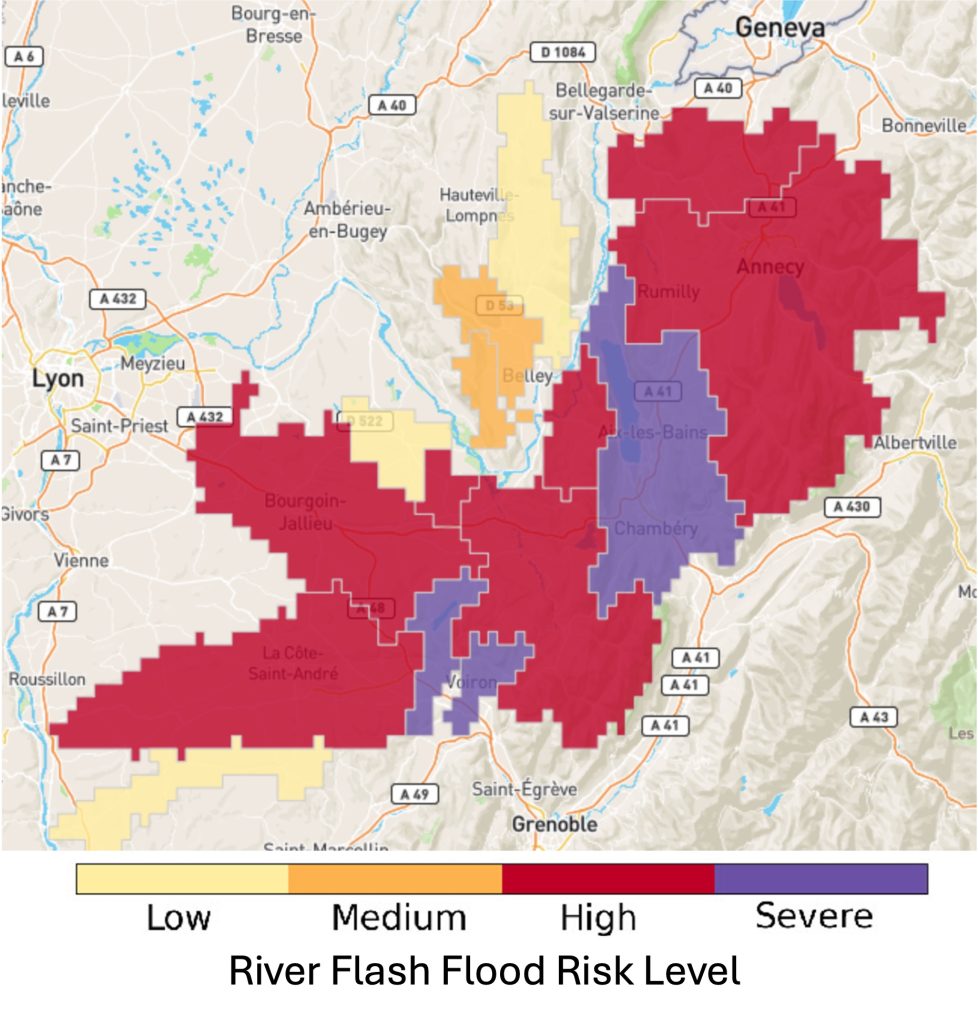
Hourly forecasts of flash flood risk level (pertaining to potential impacts) over the next 6-hours summarised over river sub-catchments.
| Spatial coverage | Europe – EFAS domain |
| Spatial resolution | Sub-catchments |
| Temporal resolution | 1-hour |
| Maximum lead time | 6-hours |
| Update frequency | Hourly |
| Units | Risk level (Low, Medium, High, Severe) |
Inputs
- Ensemble forecasts of total precipitation created by blending radar nowcast with the ECMWF IFS 51-member ensemble
- Population and critical infrastructure exposure (see static layers)
Methods
Pluvial flood hazard in urban areas
Definition
Pluvial flood hazard level in urban areas over the next 4-hours where heavy rain is forecasted.
| Spatial coverage | Europe – only areas covered by OPERA composite |
| Spatial resolution | 1-km |
| Temporal resolution | 15-minutes |
| Maximum lead time | 4-hours |
| Update frequency | 15-minutes |
| Units | Hazard level (Low, Medium, High) |
Inputs
- Hourly precipitation – radar nowcasting layer
- CORINE land cover dataset to define urban areas
Methods
Precipitation Hazard
Definition
Precipitation hazard level over the next 3-hours across Europe, calculated from extrapolated radar reflectivity observations from the EUMETNET OPERA radar composite.
| Spatial coverage | Europe – only areas covered by OPERA composite |
| Spatial resolution | 2-km |
| Temporal resolution | 1-hour |
| Maximum lead time | 3-hours |
| Update frequency | 1-hour |
| Units | Hazard level (Low, Moderate, Severe) |
Inputs
- EUMETNET OPERA radar composite
Methods
- SimVP (simpler yet better Video Prediction – Tan et al., 2025) for extrapolation, see Precipitation hazard and risk
Precipitation Risk
Definition
Risk level associated with the forecast precipitation hazard over the next 3-hours across Europe.
| Spatial coverage | Europe – only areas covered by OPERA composite |
| Spatial resolution | 2-km |
| Temporal resolution | 1-hour |
| Maximum lead time | 3-hours |
| Update frequency | 1-hour |
| Units | Risk level (Low, Moderate, Severe) |
Inputs
- Precipitation hazard forecast
- Population and critical infrastructure exposure (see static layers)
Methods
- Risk level = precipitation hazard * exposure
- See Precipitation hazard and risk
ERIC points
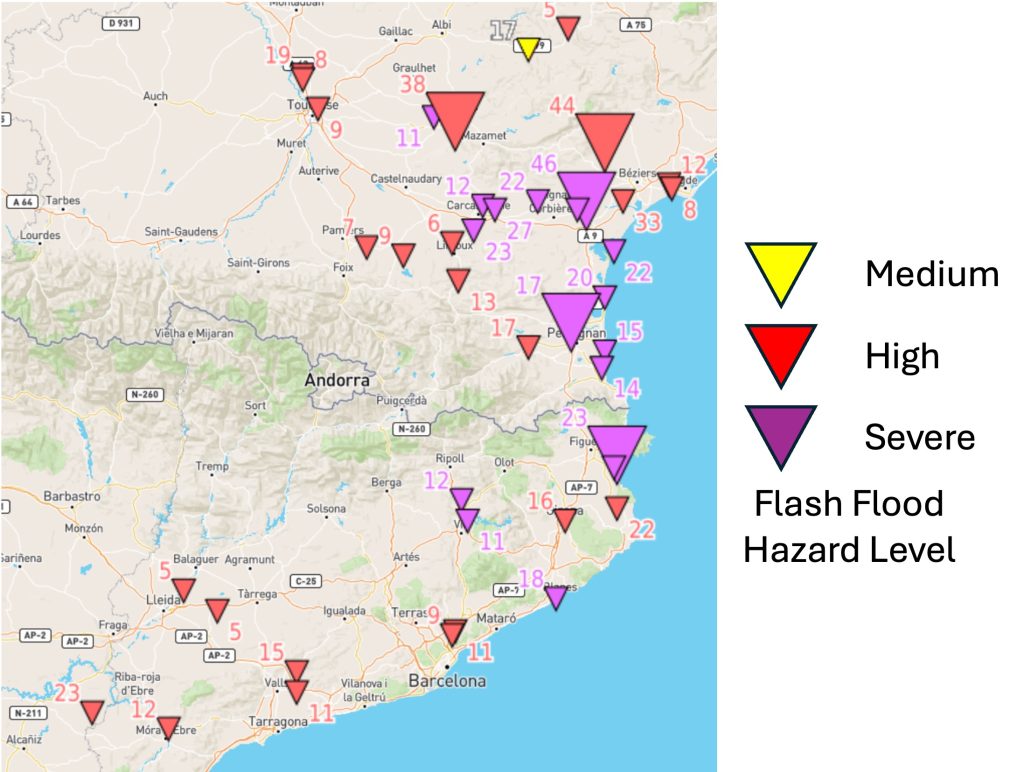
Definition
Point locations, highlighted as triangles, where river flash flood risk is forecasted in EFAS (European Flood Awareness System) over the next 5-days.
| Spatial coverage | Europe – EFAS domain |
| Spatial resolution | Points |
| Temporal resolution | N/A – single summary over the next 5-days |
| Maximum lead time | 5-days |
| Update frequency | Twice per day at 00 and 12 UTC |
| Units | Flash flood hazard level (Medium, High, Severe) |
Inputs
- European Flood Awareness System (EFAS) European Runoff Indicator based on Climatology (ERIC)
Methods
- See the CEMS-Floods wiki
ERIC affected area
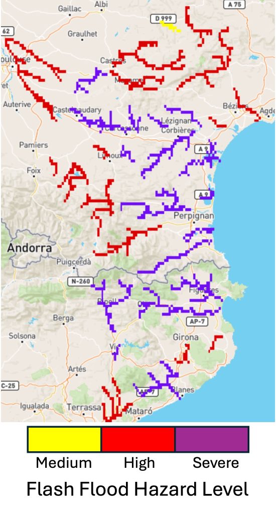
Definition
Grid cells on the river network where river flash flood risk is forecasted in EFAS (European Flood Awareness System) over the next 5-days.
| Spatial coverage | Europe – EFAS domain |
| Spatial resolution | 1-arc minute |
| Temporal resolution | N/A – single summary over the next 5-days |
| Maximum lead time | 5-days |
| Update frequency | Twice per day at 00 and 12 UTC |
| Units | Flash flood hazard level (Medium, High, Severe) |
Inputs
- European Flood Awareness System (EFAS) European Runoff Indicator based on Climatology (ERIC)
Methods
- See the CEMS-Floods wiki
Flood Probability <48h
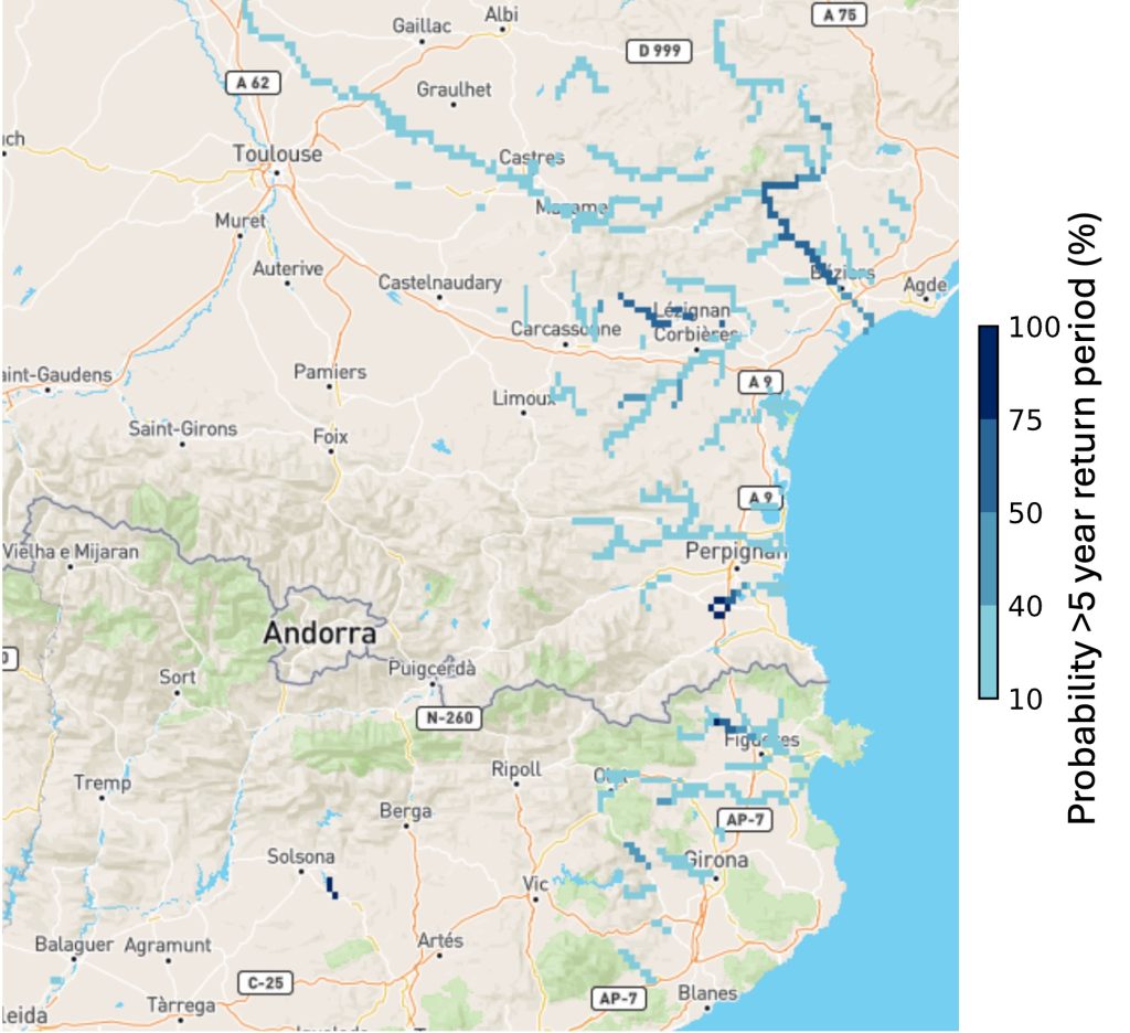
Definition
Probability that river discharge, forecasted by the LISFLOOD hydrological model within the European Flood Awareness System (EFAS), will exceed the 5-year return period within the next 48-hours.
| Spatial coverage | Europe – EFAS domain |
| Spatial resolution | 1-arc minute (~1.4-km) |
| Temporal resolution | N/A – single summary over next 48-hours |
| Maximum lead time | 48-hours |
| Update frequency | Twice per day at 00 and 12 UTC |
| Units | Probability (%) of exceeding the 5-year return period |
Inputs
- ECMWF IFS 51-member ensemble forecasts of total precipitation, 2m temperature, wind speed
Methods
- LISFLOOD hydrological model, for more information see CEMS-Floods wiki
Rapid Impact Assessment
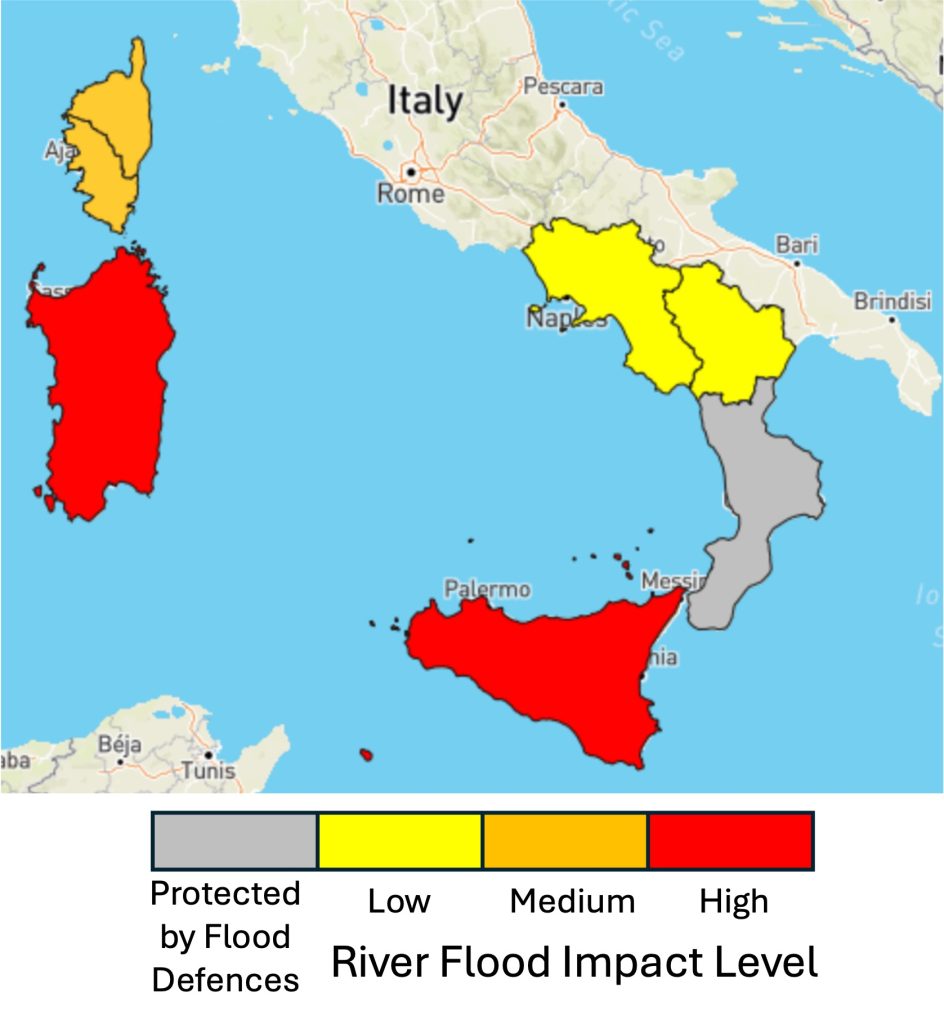
Definition
Administrative regions where impacts due to river flood inundation are possible, where the upstream drainage area is ≥150 km2, over the next 10-days. Note, this layer is not designed to highlight risk of flash flooding.
| Spatial coverage | Europe – EFAS domain |
| Spatial resolution | Administrative regions |
| Temporal resolution | N/A – single summary over next 10-days |
| Maximum lead time | 10-days |
| Update frequency | Twice per day at 00 and 12 UTC |
| Units | Official warning level (Low, Medium, High) |
Inputs
- Maximum of the 10-day ensemble median river discharge forecast produced by the LISFLOOD hydrological model forced with ECMWF IFS 51-member ensemble forecasts
- Total population from the Global Human Settlement Layer (GHSL)
- Administrative units from the Nomenclature of territorial Units for STatistics (NUTS)
- Estimated flood defences from FLOPROS and Dottori et al., 2023
Methods
- See the CEMS-Floods wiki
Flash flood past 24-h summary
Official Warnings
Definition
Warnings issued for each 24-hour over the past 10-days generated by the National Meteorological and Hydrological Services (NMHSs) across 37 European countries. Covering 12 types of hazards, these warnings are sourced from MeteoAlarm, developed by EUMETNET. The warnings are categorised as follows:
- Moderate (Yellow)
- Severe (Orange)
- Extreme (Red)
| Spatial coverage | Europe – only countries who are part of EUMETNET MeteoAlarm initiative |
| Spatial resolution | Administrative regions |
| Temporal resolution | 24-hours |
| Maximum lead time | N/A – data available for past 10-days |
| Update frequency | Once per day at 00 UTC |
| Units | Official warning level (Moderate, Severe, Extreme) |
Inputs
- EUMETNET MeteoAlarm warnings
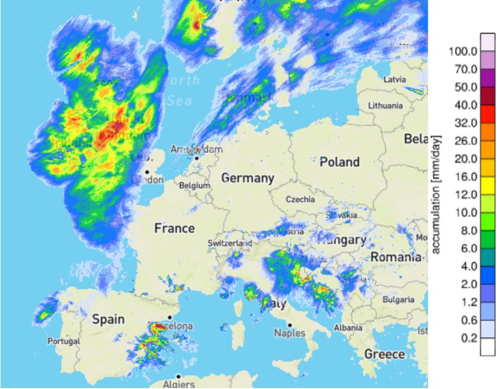
Precipitation accumulation (24h)
Definition
Daily precipitation accumulation estimated from gauge-adjusted OPERA radar composites for each of the past 10-days.
| Spatial coverage | Europe – only areas covered by OPERA composite |
| Spatial resolution | 2-km |
| Temporal resolution | 24-hours |
| Maximum lead time | N/A – data available for past 10-days |
| Update frequency | Once per day at 00 UTC |
| Units | mm/day |
Inputs
- EUMETNET OPERA radar composite
Methods
- See Radar Observations for explanation about processing of radar data
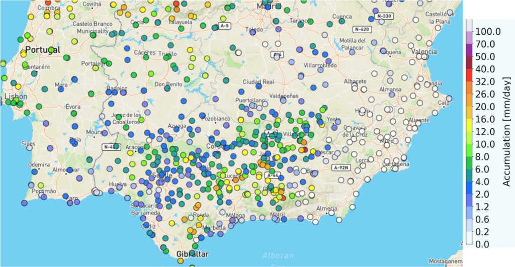
EFAS Raingauge accumulation (24h)
Definition
Daily rain gauge accumulations were reported from rain gauge networks from the WMO SYNOP and provided by EFAS partners over Europe, with additional gauges from AEMET over Spain.
| Spatial coverage | Europe – EFAS domain |
| Spatial resolution | Gauge station locations |
| Temporal resolution | 24-hours |
| Maximum lead time | N/A – data available for past 10-days |
| Update frequency | Once per day at 00 UTC |
| Units | mm/day |
Inputs
- WMO SYNOP rain gauges
- Rain gauge observations provided by EFAS partners
- AEMET rain gauges
Flash flood impact over the river network (24h)
Definition
The maximum flash flood impact level over the river network over the past 24-hours based on observations from the EUMETNET OPERA radar composite and short range NWP forecasts.
| Spatial coverage | Europe – EFAS domain |
| Spatial resolution | 1-arc minute (~1.4-km) |
| Temporal resolution | 24-hours |
| Maximum lead time | N/A – data available for past 10-days |
| Update frequency | Once per day at 00 UTC |
| Units | Risk level (Low, Medium, High, Severe) |
Inputs
- Rainfall estimated from EUMETNET OPERA radar reflectivity composite observations
- Short range NWP forecasts from the ECMWF IFS
- Population and critical infrastructure exposure (see static layers)
Methods
Flash flood impact over sub-catchment
Definition
The maximum flash flood impact level over river sub-catchments over the past 24-hours based on observations from the EUMETNET OPERA radar composite and short range NWP forecasts.
| Spatial coverage | Europe – EFAS domain |
| Spatial resolution | River sub-catchments |
| Temporal resolution | 24-hours |
| Maximum lead time | N/A – data available for past 10-days |
| Update frequency | Once per day at 00 UTC |
| Units | Risk level (Low, Medium, High, Severe) |
Inputs
- Rainfall estimated from EUMETNET OPERA radar reflectivity composite observations
- Short range NWP forecasts from the ECMWF IFS
- Population and critical infrastructure exposure (see static layers)
Methods
Pluvial flood hazard in urban areas
Definition
Maximum pluvial flood hazard level in urban areas over the past 24-hours where heavy rain was observed.
| Spatial coverage | Europe – only areas covered by OPERA composite |
| Spatial resolution | 1-km |
| Temporal resolution | 24-hours |
| Maximum lead time | N/A – data available for past 10-days |
| Update frequency | Once per day at 00 UTC |
| Units | Hazard level (Low, Medium, High) |
Inputs
- Hourly precipitation – radar nowcasting layer
- CORINE land cover dataset to define urban areas
Methods
Static Layers
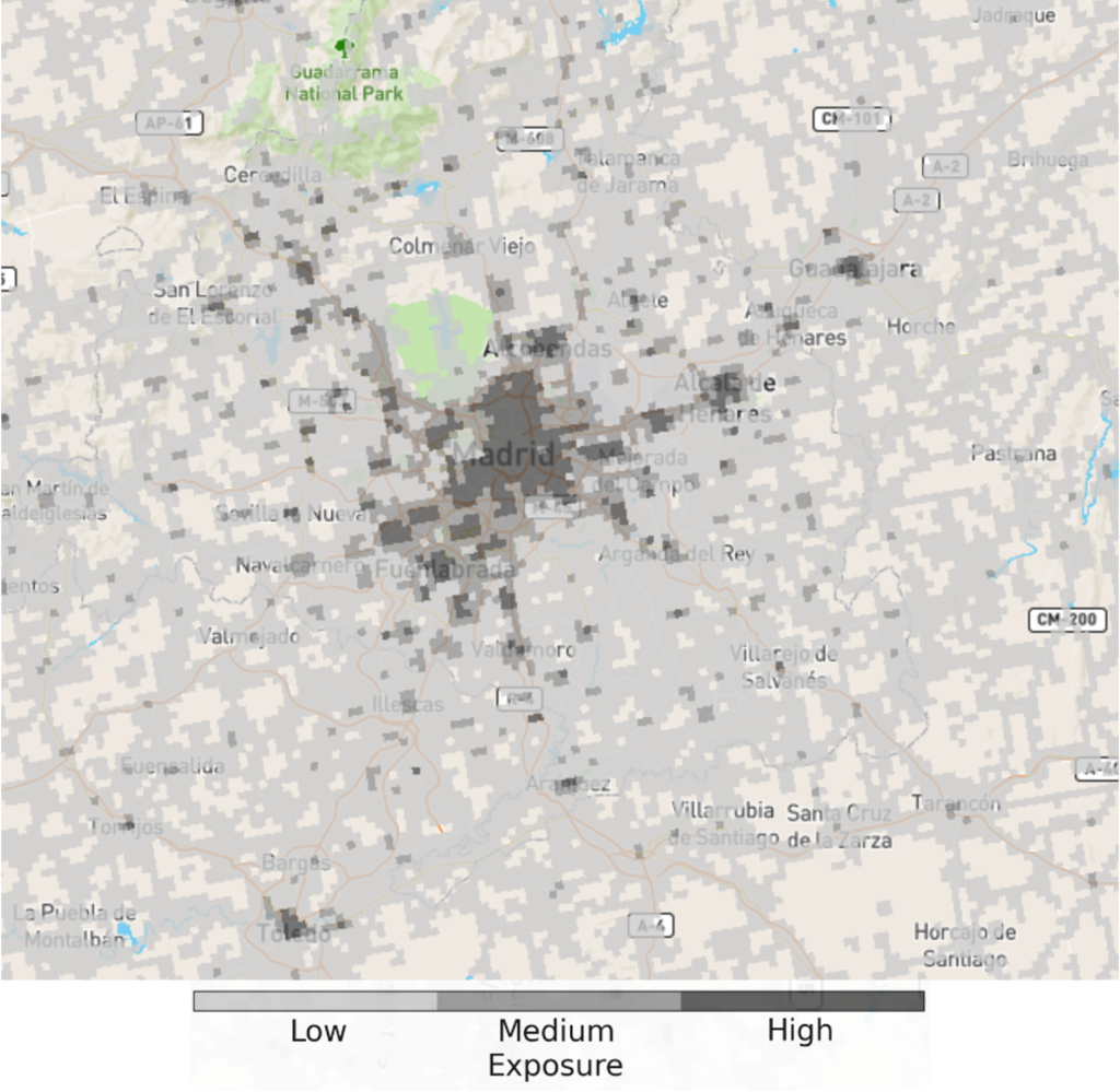
Exposure
Definition
The combined relative exposure of the population, health and education facilities, and transport and energy infrastructure in each grid cell.
| Spatial coverage | Europe – EFAS domain |
| Spatial resolution | 1-arc minute (~1.4 km) |
| Temporal resolution | N/A |
| Maximum lead time | N/A |
| Update frequency | N/A – static layer |
| Units | Dimensionless |
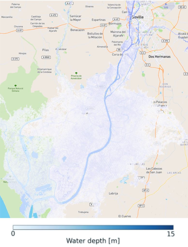
Flood Area Europe (T500), (T100), (T010)
Definition
Simulated flood inundation depth for three static scenarios: 500- (T500), 100- (T100), and 10-year (T010) return periods. Data are only available in rivers where the upstream drainage area is ≥150 km2.
| Spatial coverage | Europe – EFAS domain |
| Spatial resolution | 3-arc seconds (~90 m) |
| Temporal resolution | N/A |
| Maximum lead time | N/A |
| Update frequency | N/A – static layer |
| Units | m (metres) |
Inputs
- EFAS river discharge historical simulation
- MERIT-HYDRO Digital Elevation Model (DEM)
Methods
- See the CEMS-Floods wiki